ROANOKE, Va. – While we expect it to get very cold here Tuesday night through Thursday, keep in mind that it could always be worse. For instance, you could be in Illinois, Iowa, Michigan, Wisconsin or Minnesota this week.
Arctic air in its truest form will invade parts of the upper Midwest and northern Plains. International Falls, Minnesota already saw a low temperature of -44° Sunday morning.
Wind chills will drop toward 40, or even 50, degrees below zero at times this week up north.
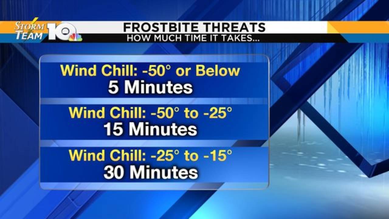
It doesn’t take long for frostbite to settle in at that point. When the wind chill is anywhere from -25° to -50°, all it takes is 15 minutes or less for frostbite to happen.

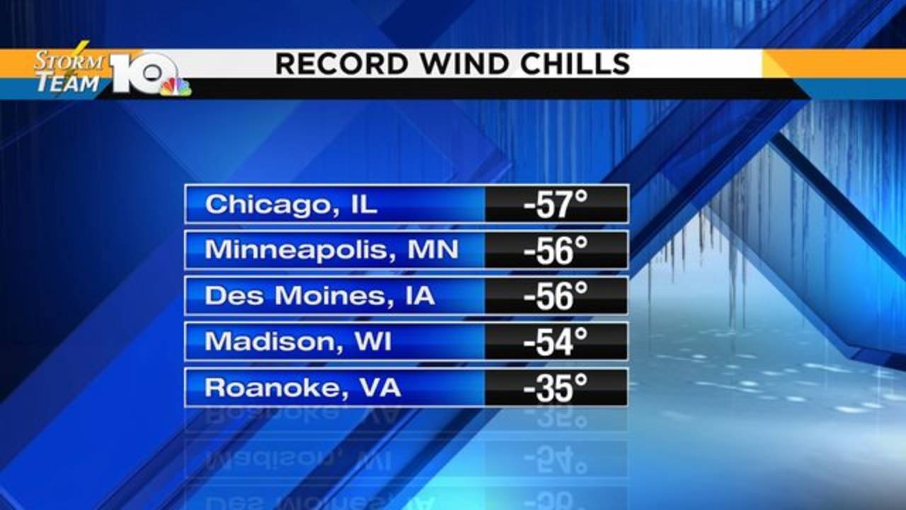
Some places may get close to record low wind chills. It’ll be tough for Chicago, Minneapolis, Des Moines or Madison to break their all-time records. Could you imagine wind chills near -60°?!

We certainly won’t break our record wind chill of -35° in Roanoke. That was set back in 1985, as were a few of the other records listed above. In both instances, a piece of the polar vortex broke off. When this happens, Arctic air plunges into the continental US.
https://www.wsls.com/weather/wind-chills-in-midwest-northern-plains-to-drop-40-or-50-below