*Tropical* Super Typhoon #Hagibis in explosive strengthening:https://t.co/sKeNXSNcX4
— severe-weather.EU (@severeweatherEU) October 7, 2019
*Tropical* Pinhole eye of Super Typhoon #Hagibis this morning, October 7th! Image: Himawari-8 pic.twitter.com/dW8OQt7mhS
— severe-weather.EU (@severeweatherEU) October 7, 2019
https://twitter.com/RyanMaue/status/1181140278457049090
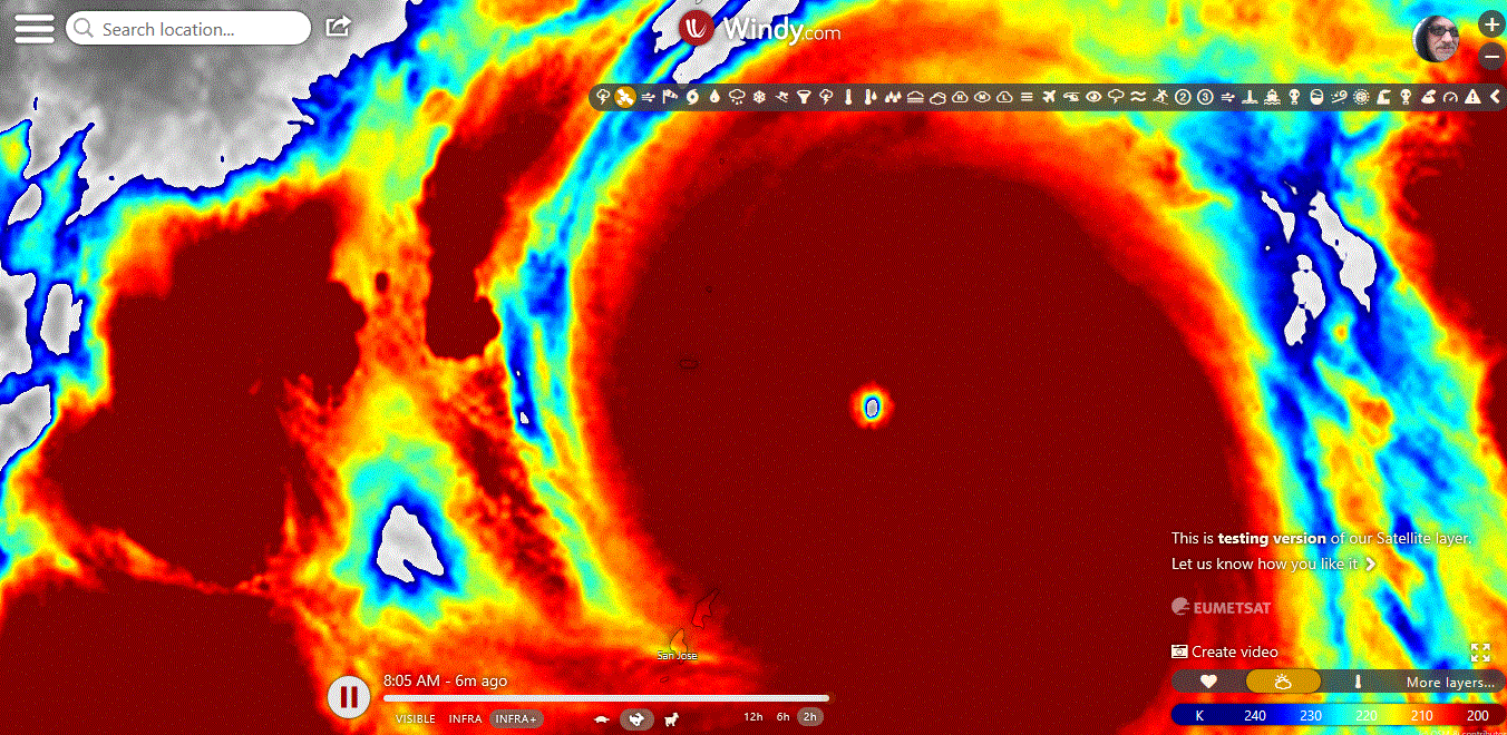
Rapid intensification of Typhoon Hagibis.
Just insane eye-clearing. pic.twitter.com/zotkhIt7qr
— Dakota Smith (@weatherdak) October 7, 2019
AVN satellite imagery means a lot to me, it was “filter” I used to load final images before super #typhoon #Haiyan hit Philippines. To see a solid donut of dark grey surrounding an eye is very rare, #Hagibis an absolute textbook cat 5 right now (Hagibis left, Haiyan right) pic.twitter.com/134P03rt4Y
— James Reynolds (@EarthUncutTV) October 7, 2019
No better example of explosive intensification in a tropical cyclone than this automated Dvorak chart. (Method of estimating intensity via satellite with max value being T8.0) Right now #Hagibis is raw T7.8, wow! #typhoon #nerdtweet pic.twitter.com/ilGPfuu2ob
— James Reynolds (@EarthUncutTV) October 7, 2019
https://www.ssd.noaa.gov/PS/TROP/floaters/20W/imagery/rb_lalo-animated.gif
Japan Meteorological Agency
Tropical Cyclone Advisory #21 – 21:00 PM JST October 7 2019
TYPHOON HAGIBIS (T1919)
========================================
nearby Northern Mariana islands (Anatahan)
At 12:00 PM UTC, Typhoon Hagibis (915 hPa) located at 16.1N 146.6E has 10 minute sustained winds of 105 knots with gusts of 150 knots. The cyclone is reported as moving west northwest at 15 knots.
Storm Force Winds
==============
100 nm from the center
Gale Force Winds
============
350 nm from the center in the eastern quadrant
240 nm from the center in the western quadrant
Dvorak Intensity: T6.5-
Forecast and Intensity
==================
24 HRS: 18.4N 141.9E – 115 knots (CAT 5/Intense Typhoon) West of Northern Mariana Islands
48 HRS: 20.9N 139.5E – 105 knots (CAT 5/Intense Typhoon) Sea South of Japan
72 HRS: 24.2N 137.4E – 100 knots (CAT 4/Very Strong Typhoon) Sea South of Japan
h/t Luisport