by mapi

An infographic from the Future of Privacy Forum describes how mobile devices, such as smartphones, interpret signals from their surroundings – including GPS satellites, cell towers, Wi-Fi networks, and Bluetooth – generate a precise location measurement (latitude and longitude).
“This measurement is provided by the mobile operating system to mobile apps through a Location Services API when they request it and receive the user’s permission. As a result, apps must comply with the technical and policy controls set by the mobile operating systems, such as App Store Policies.”
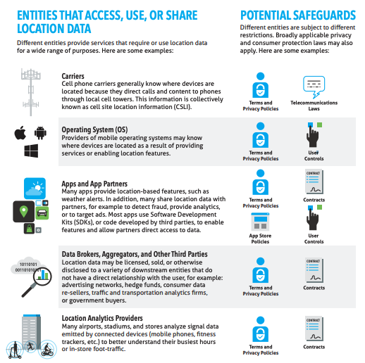
“Many different entities (including, but not limited to mobile apps) provide location features or use location data for a variety of other purposes. Different entities are subject to different restrictions, such as public commitments, privacy policies, contracts and licensing agreements, user controls, app store policies, and sector-specific laws (such as telecommunications laws for mobile carriers). In addition, broadly applicable privacy and consumer protection laws will generally apply to all commercial entities, such as the California Consumer Privacy Act, or the Federal Trade Commission Act.”