How Government Entities Use Geolocation Data To Identify Everyone
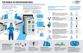
by mapi credit: Future of Privacy Forum An infographic from the Future of Privacy Forum describes how mobile devices, such as smartphones, interpret signals from their surroundings – including GPS satellites, cell towers, Wi-Fi networks, and Bluetooth – generate a precise location measurement (latitude and longitude). “This measurement is provided by the mobile operating system to mobile apps … Read more